Monday, October 16, 2017

Appalachian Trail - Connecticut FKT

Flat section around mile 19


After getting absolutely destroyed by the New York FKT attempt of the Appalachian Trail I wanted something to hang my hat on before the end of summer.  The FKT for Connecticut had in the back of my mind since last year, when I being really exploring the trail in NY and set the record in NJ.  When it turned out Elizabeth and I were headed up to Massachusetts for the weekend, it made sense to leave a day early and try to take some time off the current record.

Elizabeth and I arrived at the NY/CT state border at 5:15am on Friday morning, planning for a 5:30am start.  I hadn't run more than 50 feet on the Connecticut AT section, so I would be on new trail all day.  To start, I wore a light singlet and a hand-held water bottle, opting to switch to my hydration pack when I saw Elizabeth after the first 4-ish miles.  After walking out to the starting point we decided it was still a little too dark, and pushed the start to 5:40am.  A small satellite snafu pushed us back another minute, and I was officially on my way at 5:42am.

2nd time starting here, 1st time going north
The trail started out a bit technical for the 1st half mile before crossing over Rt. 55, then proceeds to flatten out a bit before the 1st climb of the day up Tenmile Hill.  I passed a tent at the base, and thought to myself I hope I don't startle them.  I felt great climbing up the hill, though my heart rate was a bit higher than I was hoping.  After jogging down the backside of the hill, the trail parallels the Housatonic River for the next mile or so.  I was being to warm up and moving quickly to try and match the pace of the current FKT holder, Scott Gregor.  I don't know Scott personally, but he is a phenomenal runner and has been tearing up trails all over the northeast for the last several years.  I eventually reached Bulls Bridge Road around 4 miles in and proceeded down Schaghticoke Road and found Elizabeth on the side of the road, just before the trail dips back into the woods.

Out of the singlet, into the tri-top
I arrived at the aid station almost exactly on pace, in about 42 minutes.  I swapped my singlet and handheld for a tri-top and a hydration vest, as the next section was a bit longer (about 7 miles).  I took a banana and some ginger snaps and made my way back onto the trail.  I was immediately greeted by one of the more difficult climbs on the route, Schaghticoke Mountain.  The trail climbs roughly 900 feet over the next 1.8 miles, with some technical spots.  I took my time going up, eating my ginger cookies and drinking water as I proceeded.  Once up the mountain, the trail skirted across the ridge with some great runnable sections as well as technical spots.  I passed a few hikers on my way down to the next road crossing, near one of the creeks that flows into the Housatonic River.  After exchanging pleasantries, I dunked my hat in the cool water, and continued to run.  The long descent took me across Old Barn Road and I found Elizabeth shortly after at Macedonia Road.

The early views were covered in a thick layer of fog
I was about 10 minutes behind pace, arriving in 2 hours 14 minutes.  I tried to eat as much as I could while Elizabeth refilled my water bottles.  I was still feeling good at this point and I knew I only had about 5 miles until I arrived on River Road, which was flat for about 5 miles (something I was very much looking forward to).  I stayed at this station a touch longer than I would have liked but eventually got back underway and jogged across the field on the other side of the road.

After crossing the field, I was greeted by another difficult climb, though I'm not sure of the name.  I was becoming mentally exhausted, which was unusual for me this early into a race/event, and proceeded to walk the entire hill.  I tried to get into a rhythm as soon as the trail leveled off, but found myself stopping shortly after for a view at St. John's Ledges.  I continued on, feeling more relaxed knowing I was approaching the flat section.  Making my way across Skiff Mountain Road, I proceeded up Caleb's Peak.  There was fantastic view near the top, and I was able to stop for a quick photo and chatted for a minute with a thru-hiker taking a break at the vista.  The descent down was long and technical, and I was having trouble moving quickly with my less-than-100% ankle causing me some discomfort.  About half-way down, I cam across a 2-ft snake in the middle of the path.  It scurried out of the way seconds before forward momentum would have landed my foot right on it.  Researching after the run, I concluded it was either an Eastern Ribbonsnake or Eastern Garter, both are nothing to worry about.  I continued down until finally emerging onto a dirt/gravel road close to the Housatonic.  I presumed this would lead me to Elizabeth, who was planning on meeting me at the start of the flat section of River Road, and I carried on.

St. John's Ledges represented the first real view of the day

Good things come in pairs
I trotted down the dirt road awhile before I started to get concerned.  I still had not seen Elizabeth and the path showed no sign of any real road coming up.  I was a mile further than I expected the road to be, so I stopped and tried to call Elizabeth.  It took 3 tries before the call went through, but no answer.  I left a message saying the trail must have been mislabeled on the map, and to meet me at the next station, another 7 miles further.  At this point I was running low on water, but luckily could resupply at the Housatonic River, which paralleled the trail.  This was another low point mentally, and I couldn't get myself to run for more than a mile or so at a time.  After passing a campground and going through a field or two, the trail finally diverged from the path and I made my way up Silver Hill.  There was a nice overview at the top where some day-hikers had stopped for lunch but I was trying to move quickly so I didn't spare any time to chat.  After a steep (but not technical) downhill Rt. 4 was in sight.  I told myself that if Elizabeth was not there I would drop abandon the FKT attempt and try to congregate with her.  At first I didn't see her and a wave of relief washed over me.  But sure enough, I saw her Ford Escape just a few yards up the road, with her sitting in the front seat.

Taking my time down the steep descent
Once I arrived I found out she had her own obstacles in that section.  Apparently the road we were supposed to meet on was closed today so she was desperately trying to find another way to see me (this included yelling for me at the top of her lungs into the woods, which I did not hear).  Thankfully we found each other at the next aid, though the spotty service meant she never actually got my message.  However, she being there meant I needed to keep going, which was difficult to wrap my head around.  I had some PB&J and Fritos as well as much needed water and Gatorade.  I was looking for her to give me any excuse to drop out now, but she made it clear we were not calling it quits this early.  After refilling my pack and wishing me well, I was off once again.

Wanting to quit less than half-way in
This next section was relatively short (4.9 miles) but I struggled to maintain any semblance of my intended pace.  After the intial climb up Bread Loaf Mountain (actual name) I arrived at the Pine Knob Loop Trail, which is indicated by light-blue blazes, and shares the AT for the next 3/4 mile before splitting off again.  I passed several day and thru-hikers during this section, which allowed me to take a few mini-breaks to chat.  I spoke with one young woman as I passed through, "Hope the weather holds out" I remarked, and she agreed, as the clouds were starting to close in.  The weather didn't hold and within a minute, it was down-pouring.  Despite what I said, I welcomed the relief from the heat, and was happy the rain was keeping the bugs away.  There were several other day hikers making their best attempts to stay dry, but to avail.  Toward the end of this section I began feeling much better and the mile times began to slowly decrease.  The rain stopped shortly before I hit my next aid stop at W Cornwall Road, where Elizabeth was waiting for me.

The rain kept me from using my phone so here's another great lookout from the last section
I dropped my pack off and immediately darted back into the woods for a bathroom break.  When I returned I felt even better than before and found Elizabeth had already refilled my water bottles and set up some food options.  I settled for a BLT she picked up at a local gas station and it tasted incredible.  I wolfed down half of it and had her save the 2nd half for the next station.  I believe I also had some Fritos and possibly a Mountain Dew at this stop (my memory is a bit hazy here).  Feeling much better and trying to move quicker through the stations, I headed across the road where the next section awaited.

I knew that after this section there would be 4 miles of flat trail, which got my spirits up.  After the initial climb, I began to run again, this time feeling stronger.  I begun calculating the pace I would need to break the record and realized I was already a bit behind.  I became obsessed with keeping my miles under 15 minutes and only walking during the more difficult climbs.  The air was humid and the bugs began to emerge again.  I jogged by a couple with there pants down (oops) and tried to mosey by without an awkward encounter.  "Sorry" I yelled as I passed.  They did not appear too concerned or embarrassed.  The trail in this section was extremely runnable, without many interruptions for hills or rocks.  Eventually I started to climb Sharon Mountain and my pace slipped again.  But I ran strong on the descent and before I knew it I was back on the road headed toward Housatonic Valley Regional High School, where Elizabeth would be waiting.  I was able to pick up the pace on the road and felt really good knowing that the next sections would be almost entirely flat.

The calm before the storm (Pt. 2)
After turning onto Warren Turnpike Road, I quickly spotted Elizabeth in the school parking lot with the food already set up.  I arrived and finished off my sandwich from earlier, explaining to her how well the last section had felt, as I stuffed my face.  While I was indulging, a man came up to us and asked about what we were doing (he had seen me earlier on the road).  We explained the record attempt and chatted for a few minutes before left and wished us well.  The monsoon was back, and soon I was scrambling to get my pack together so I could run through the next section.  Before I left I requested an ice cream sandwich for the next section, to which Elizabeth gladly said she would pick up.

Jogging into the High School parking lot
I began running down the road to the tune of thunder and lightning, my shoes and socks becoming soggy with every step.  I passed a thru-hiker just before re-entering the woods, and thought about the challenges rain presents to those going the full distance.  The trail aligned with the road for the next half-mile or so, and although it was not technical, the lack of drainage made it extremely rough going.  Eventually I crossed over Warren Turnpike Road and into a small park.  I passed by another hiker who had set up a tent roof and was casually reading a book in the middle of the monsoon.  I envied his patience, but continued on.  Surging forward and completely drenched, I advanced to Water Street.  I traveled down Water Street, which aptly lived up to it's name, and found the next trail inlet at Falls Mountain Road.  This small section may have been the most water-laden trail I have ever run.  It constantly felt like I was running directly up a stream bed, as water flowed toward me and into the Housatonic River to my right. After stopping for a quick video to record the downpour, I arrived at the car, quickly jumping in the trunk and shielding myself from the rain.

No caption needed

No that's not sweat
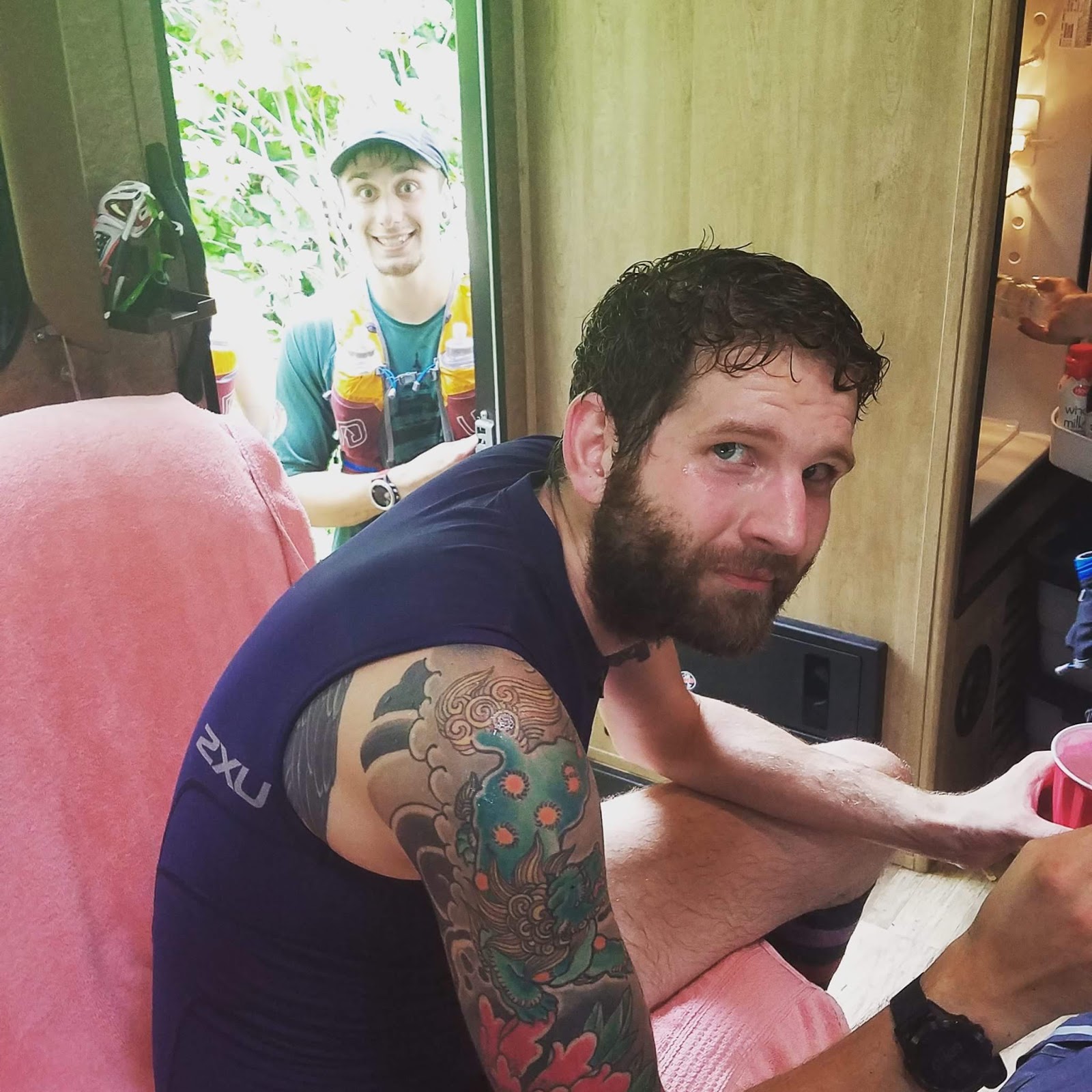
Photobombing myself with my own phone (showing Elizabeth the video above)
As promised, I had two ice cream bars waiting for me.  I practically inhaled them as I recounted the last section to Elizabeth, who stayed in the front seat this time.  The next section started with one of the most difficult climbs of the day, and I knew I would need to keep the aid stops to a minimum if I was going to have a chance at the record.  After a few more chips and water/gatorade I was on my way again.  Just before jumping back into the woods I stopped and applied some Chafex to my inner thighs, took one last look back at Elizabeth, and proceeded up the climb.

Possibly my favorite trail marker of the day
I passed some day hikers as I ran through a small field before reaching the climb.  I asked if the climb was as bad as everyone said (though honestly no one told me it was bad, it just looked bad on the elevation profile).  The assured me it wasn't and moments later I was surprised to find out they were mostly right.  I glided up the hill, stunned that I had finished so quickly.  Once at the top, the trail migrating in and out of field edges, following a gentle downward grade most of the time.  I was running fast and feeling good.  This section was busier than most, with several thru-hikers attempting to reach the state line.  I got behind a small group as we hiked up a smaller climb, and chatted for a few minutes.  We were both headed to the state line, and they wished me well as I slipped by them.  I passed a collection of day-hikers as I neared Canaan Rd (Rt. 44).  After a soggy stretch alongside the road, I emerged onto the road.

Rock

I'm not sure this is OSHA certified
I told Elizabeth that if she couldn't find parking at Rt. 41, to meet me at this intersection.  When I didn't see the SUV, I knew she must be waiting another mile ahead.  I was happy she was at the next road, as I wanted to use the new-found energy instead of stopping.  I expected the trail to go straight across the road here, but it turned left on Rt. 44.  I made my way down the road, following blazes carefully and making sure I wasn't straying off path.  Eventually I made the right-turn down Cobble Road and another right into a large field and back into the woods.  The trail here was flat and mellow, great for walkers and the like.  After a short jog through this section, I arrived at Rt. 41.  At first I didn't see Elizabeth's SUV, but quickly spotted it in a parking lot the trail was leading to.  The rain appeared to be completely gone, and the weather was perfect.  She got out of the car and was setting up the aid when she sensed my urgency.  I told her I need to move as fast as possible if I was going to have a shot at the record.  Realistically, I knew I had some time to spare, but I didn't want to break the record by only a minute or two.  I gulped down a Monster Energy (which is something I NEVER drink anymore, this was the 1st energy drink I'd had since 2013).  I chugged the whole thing, had a few chips, then spent 30 seconds talking to Elizabeth about the last section, the section coming up, and the finish area.  (Looking back, we should have spent another 10 seconds identifying a key detail, see the last paragraph).  I left the aid station bottles filled, ready for the final push to the state line.

No better way to make what I'm doing seem insignificant
This section contained the climb up the infamous Bear Mountain, the most difficult climb of the day.  The trail started climbing immediately, and I power-hiked up, running wherever I could find a flat section.  There were plenty of thru-hikers and day hikers alike on the trail, which was mostly a double-wide gravel path.  I continued climbing, sometimes running the uphill sections if they were short.  I felt great, but was concerned the real climb hadn't begun yet.  Eventually the trail narrowed and veered left and down into a valley.  I could see "Bear Mountain" in front of me (notice the quotes), but couldn't quite believe it still had so much climbing left.  Eventually I reached the "real climb" and there was no mistaking it (again, the quotes).  I hiked hard, making sure to keep under 20-minute mile pace.  The trail split with the Appalachian continuing up to my right, while another trail followed the mountain down to the left.  I kept hiking, and the further I went, the rockier the trail got, until I was climbing up massive rocks near the summit.  This part of the trail was reminiscent of the climb up West Mountain from the Palisades Parkway in NY, also part of the AT.  I saw people at the top and decided even though I was short on time, it was worth taking a break to enjoy the view (and catch my breath).

Best view of the day

I wasn't the only one admiring the view

Selfie!

Ok this is getting ridiculous, time to go
After a few pictures, a found my way back to the trail.  The path followed the ridge for a while and offered another view of the opposite direction, but soon meandered down the ridge.  I picked up the pace, realizing how close I was to missing the record.  I didn't know exactly when I would arrive at the state line, and was trying to calculate the distance based on my watch, comparing when I arrived at the top of the mountain to when Scott had.  I knew I must be close and I continued to push the pace, jumping down into the 9:00-range at times.  I passed several trails that looked like they could be the side entrance that Elizabeth would take to meet me.  But with each one, the trail showed no signs of changing states.  Then the trail began to climb again, which surprised me as I had thought the climbing was finished.  A run turned into a power-hike turned into a walk, but the trail was unrelenting.  I slowed my pace feeling mentally defeated.  I was frustrated that I didn't know exactly where I was or why I was climbing this far in.  I didn't dare spend the extra time to check my phone for context to where I was, and I was sure I wouldn't have had service anyway.  Eventually I arrived at this 2nd summit, to find that I was just now arriving at the peak of Bear Mountain (the previous peak being a mountain called Lion's Head).

I should have paid closer attention to this sign

The REAL Bear Mountain view (though I didn't climb the monument)
I persisted, realizing now that I was in the home stretch of the event.  To my dismay, a steep technical descent awaited, and I was forced to tip-toe down.  I sped through as fast as I could, almost losing my balance on more than one occasion.  After a frustrating downhill, I sped up once again.  The trail was slow and easy to run now, and after seeing a turn-off to my left, Elizabeth was finally in sight.  I dashed forward excited to find the state-line sign.

Arriving at the finish line!
Ignoring the finish line
I yelled to Elizabeth as I passed that I needed to find the official sign, and ran ahead.  I trailed slightly switchbacked downhill before arriving at the Sage's Ravine campsite.  On my way down, I did stop to read a sign which I thought could be the one Scott had used as his endpoint, but did not recognize it as the correct one.  I traveled on, running across the bridge to the campsite looking for the sign, but again could not find it.  I frantically continued back across and continued on the AT once again.  With every step I was sure the sign would be just around the bend.  I had less than 5 minutes to find it.  I sped up again, jumping over rocks and roots as the trail became more technical, but the sign was nowhere in sight.  With about 90 seconds left, I gave up.  I found a spot overlooking the stream, and sat down, removing my pack.  I couldn't believe that I had come so close, with the sign being just out of reach.
The view after time expired
View from the other side after time expired
Post-Run:
After a few minutes in my pity party, I backtracked toward Elizabeth, who I imagine had no idea what was going on.  I walked the entire way, restarting my watch on 'hike' mode so I could see how far I had run past her.  I eventually reached her by the Sage's Ravine Campsite, where I announced that I never found the sign.  She mentioned that, according to Google, she had been standing exactly on the state line.  Not good enough, I thought to myself.  I needed to find the sign that Scott used as the finish point.  Apparently I had not shown the sign to Elizabeth, so I pulled up a screenshot I had taken with my phone.  "I'm pretty sure you passed that", she explained.  We backtracked more, as we need to head in that direction anyway, and found the sign I had glanced at after I passed her.  Sure enough, It was the correct sign, and I had remembered it differently in my "altered" state-of-mind (runner-brain, as some ultrarunners say).  I couldn't believe I had actually done it, but I still had a problem.  I didn't know exactly what time I passed the sign.  But I could worry about that later.  For now I was excited to be done.

This has been the longest I have ever spent on a race report, so I may be a little foggy on some of the final details.  I did my best to recount as much information as possible, but honestly, in over 50 miles of AT running, some of the sections do tend to blend together.

After carefully reviewing my GPS data on Garmin Connect and Strava, I have concluded that I arrived at Sage's Ravine in 12:47:19.  I cannot pinpoint the exact time I arrived at the sign, but seeing as this was the closest landmark after passing the sign, this is a time I feel comfortable posting as the new FKT.
Notice the time in the lower-right hand in conjunction with the position on the map
The run challenged my weaknesses more than my strengths, and I am a better trail runner now than when I began.  I am not strong on new terrain, when things seem out of my control (see NY FKT attempt) so this was a fantastic way to improve in that area.  Thank you so much to Elizabeth who spent the whole day chasing me around the woods, only to be rewarded with a cranky, tired, and sore boyfriend.  I would also like to mention that I plan on running this route again, and improving on this time now that I know the course and most importantly, where it ends.

Cheers!


Gear:

Watch: Garmin Fenix 5
Shoes: HOKA Challenger ATR 3
Socks: Injinji & Drymax
Pack:  Ultimate Direction AK 3.0
Gels:  Huma
Anti-chafe:  Chafex

Wednesday, July 26, 2017

2016 JFK 50 Mile - Race Report

Preface:
The JFK 50 Mile is one of the oldest and revered ultramarathons in the United States, with more than 1,200 participants registering annually.  The course is point-to-point, traveling from the center of Boonsboro Maryland to Williamsport.  After a brief 2.5 road miles to start, the course endures 13 miles of the Appalachian Trail before entering the C&O Canal towpath.  26.3 miles later, runners emerge onto the roads of Williamsport, where rolling hills and gusty winds lead athletes to the finish line at Springfield Middle School.

Pre-Race:
Elizabeth and I drove down to our hotel in Hagerstown Maryland on Friday afternoon, roughly a 4 hour drive.  I felt completely recovered from my previous two ultras, the SRT Run/Hike in September and the Nipmuck Trail Marathon in October.  I had some last minute shoes problems in the week or two prior to the race, and decided to use the HOKA Stinson's for the Appalachian Trail portion of the race, then switch into the HOKA Speedgoats for the towpath (my original plan was to use the Speedgoats for the entire race, but they were causing blisters on my outer toes in rocky terrain or when the pace was under 6:40/mile, a speed I'd be nowhere near on race day).  This race would also serve as the first 50-miler where I only used a single hand-held water bottle.

I choked down a few muffins and a banana during the pre-race meeting held in the Boonsboro High School gymnasium.  My eyes wandered across the walls, which are decorated with championship teams of various sports.  The meeting adjourned and Elizabeth, myself, and 1,200-ish other runners made our way to the start line on Main Street in downtown Boonsboro.  After a 10-minute walk I ended up jogging to the start line to avoid missing the start.  I caught a glimpse of Jim Walmsley just before the race commenced.  He was brimming with energy, excited I'm sure to be testing himself against Max King's course record.  His excitement was rubbing off on everyone around him and before we knew it, we were on our way.

Part 1 - Appalachian Trail:
My race began about 8 rows of ultrarunners behind Jim, but I got to catch another glimpse of him as he began to ascent the first hill about a mile into the race.  He already had a good quarter-mile lead on me.  I began to settle in to a pace right around 8:00/mile, clocking my first mile in 8:15 as we began the first ascent.  Because the first 2.5 miles are on road, it's easy to get swept up in the pace.  I consciously monitored how much effort I was putting in, which resulted in walking about half the hill.

We approached the entrance into the trail and to my relief there was Porta-Potty just before entering.  I took a minute inside before pressing on, and immediately tried to climb back into position, but it proved mostly futile during this semi-technical section.  It wasn't long until we hit a paved path and I was able to regain some of the time I lost.  I mostly kept to myself, solely focused on my race as others talked around me.  The course was more crowded than I was used to for an ultra, and remained that way until we left the paved path and made our way onto the singletrack.  Once the single-track approached, I felt more at ease.  I began gliding over the technical segment, while many of the other runners slowed to a crawl.  "ON YOUR LEFT" became my chorus for this section.  Before I knew it the 1st fully-stocked aid station was in view at mile 9.  I chugged what was left in my bottle and entered the pit.

The 9 mile aid station went just about as well as possible.  Several race volunteers were in front with gallon jugs of water for bottle fills.  A nice young woman filled mine quickly and said I looked strong.  I trotted through the rest of the station and grabbed a handful of pretzels on my way out.  There is a small climb before entering the woods again which gave me time to walk and eat and drink.  Even with this delay, my next mile split was ~11:30, a great aid-station mile.  I was feeling strong and the day was beginning to warm up.  At mile 10 I was able to check my pace compared to other runners which had been around 8 hours, and found I was only 1 minute behind where I estimated I needed to be.

SIDE NOTE:  Prior to the race, I looked up 5 runners that were all near my goal pace of 8 hours, and documented their 10 miles increments via Strava in order to generate a better approximation of how long it should take me to run each section (instead of trying to maintain a set pace throughout, because some sections were more difficult, like the AT section at the beginning).

I followed a few other runners through the singletrack for the next mile or so, and eventually found myself running alone.  It was calming to finally have a moment to myself and I felt like I was able to relax and enjoy the trail.  There were several Boyscout (I presume) groups hiking this section  They were extremely polite letting me pass as well as providing some encouragement.  I was becoming antsy and decided to slightly pick up the pace.  I knew there was only a mile or two before the aid station and that the steep technical switchback section ahead would slow me down.  Sure enough, the descent quickly approached, and I was forced to carefully meander down the path.

I ran through the aid station and found Elizabeth standing on the tail end with supplies.  The goal was to keep this stop under a minute, which was optimistic because I was changing out of my cushioned Hoka Stintons and into the faster Hoka Speedgoats.  While making the switch, Elizabeth was filling my water bottle and making sure I was shoveling food down my throat.  Oranges, pears, and some potato chips would fuel the next section.  After a quick kiss and thank you I jumped back onto the trail, invigorated by the new, lighter footwear.  I ran through under an overpass, through some singletrack, and across a railroad, finally arriving at the C&O Canal Towpath.

Part 2 - C&O Canal Towpath:
I was familiar with the towpath from pacing my friend Scott at the C&O 100 earlier this year, though it doesn't take long to become familiar.  The path runs parallel to the Potomac River on your left, and mostly woods/local roads on your right.  The path itself is double-wide and non-technical, almost entirely consisting of soft dirt with touches of gravel here and there.  The weather was perfect now and I felt fresh and fluid as my pace quickened.  It was a strange transition during this phase, many racers began to shift positions as the faster road runners moved up and the trail runners were keeping a steady pace.  I picked the pace up, testing the new-ish shoes against the soft ground, and was running in the range of 8:15-8:30/mile.  Knowing I would be on this path for the next few hours, I tried to keep my mind busy with mental math of exactly what my pace was, how long until the next time I saw Elizabeth, etc.

There were several remote aid stations on the path, each about 3-4 miles apart.  I did my best to move through them quickly, only spending enough time to grab a handful of chips and fill my water bottle; sometimes not stopping at all.  The pace began to slow as my legs began to feel the weight of 30+ miles.  I came through the marathon in 4:04, just a few minutes shy of my goal.  Soon after, I hit my 50k in 4:49, my fastest ever 50k.  Eventually I saw Elizabeth again around mile 37 fully prepped with food and water.  As I was refueling I saw my friend Amos with his dog at the station.  Amos is a fantastic runner and I rely on him for race advice from time to time.  Today was no different, and he was able to encourage me to keep moving and not take too long at the aid station.  I had begun to develop a bit of chaffing in my inner thighs, and I ended up walking as soon as I lost sight of the aid station, frustrated that I did not spend an extra moment to reapply some Chafex (anti-chafing cream).

I was concerned that the day was beginning to unravel, despite coming through the first 50k faster than I ever had in a 50-miler before.  I begun a run-walk strategy, and was leap-frogging another runner for the next mile or so.  I noticed I clocked my next mile at 10:50, even though I was walking quite a bit of it.  I started to focus on my instantaneous pace, which was still 9:00-9:20/mile while I was running.  In the distance I could see the next aid station, situated at the turn off the canal path onto the final 8 miles.  I ran into the aid station strong but tired.  Luckily, they had Mountain Dew here (I hadn't had any caffeine).  I gulped down 2 full cups and made my way onto the road, the volunteers shouting encouragement as I left.

Part 3 - Rolling Hills to the Finish:
The road section starts with an immediate 180-turn so the runners behind you are visible as you exit.  About 100 meters later, you encounter a small but steep hill.  I used this hill to digest the soda I'd just drank, and walked the whole thing.  Feeling refreshed at the top, I began to run.  I was playing mental games with myself trying to figure out what my finishing time would be and what pace I needed to keep.  I arrived at the road in almost exactly 7 hours (6:57 for the number junkies), which would give me an hour and 2 minutes to break 8 hours, or roughly 7:30/mile.  8 hours had become a fantasy.  The next goal would be to break my friend Andy's PR time of 8 hours 20 minutes (there was a case of beer at stake).  I would need to keep a 10-minute mile.  That would be difficult but not impossible.  I started to pick up the pace, focusing on a few runners in front of me.  I passed them quickly, becoming more confident with each stride.

I arrived at the next aid station feeling strong and determined to finish the remaining 4-5 miles.  After taking a quick 30 second bathroom break and a cup of Mountain Dew I was back on the course.  My legs were feeling exhausted but I did my best to push through it, only walking on the more difficult rolling hills.  Eventually I arrived at the last aid station, about 2 miles away from the finish, and proceeded to run right through it.  I was a minute or so over 8 hours at this point, and would need to push the last 2 miles to have a chance at breaking 8:20.  I started picking up the pace again, dropping down near 7:00/mile pace on the next downhill.  Shooting pain immediately ensued in my right hip, and I quickly eased back to a comfortable pace.  I was still moving ok, but more importantly, feeling good as I made the final turn.  The finish line came into view and a minute or so later I crossed the line in 8:17:40, where Elizabeth was waiting for me.


Part 4 - Post-Race
My time ended up being an 89-minute PR for the 50 mile distance.  It was a race that lended itself to my strengths, smooth gravel footpaths instead of steep rocky trails.  I was just as excited with my time as I was to learn that Jim Walmsley had smashed the course record by 12 minutes!  I sheepishly said hello to him after the race, he was incredibly nice and humble.

Thanks to Elizabeth for once again spending a long day crewing me (even though I only got to see her 3 times).  In hindsight, there were a few things I did differently in this race that seemed to help my overall performance.  I ran the entire race with a single 20 oz handheld, and didn't have any trouble with the weight on my arms instead of my chest/back.  I also changed shoes at mile 16 to a shoe that was better suited for handling the soft gravel path.  If I had a road shoe ready, I could have worn that as my 2nd shoe and perhaps had an even bigger PR.

Overall it was a great race experience, the volunteers were incredible and the aid stations were well stocked.  The backroads at the end of the race also have very little traffic so those concerned about that can rest easy.  The only blemish is the race price is outlandishly high ($225) for a 50-miler, and though I am sure to come back eventually, it probably will not be for a couple years.

Thanks for reading and be sure to click FOLLOW at the top of the page for updates on future race reports.

Cheers!

Strava:
https://www.strava.com/activities/782478100

Tuesday, July 18, 2017

Appalachian Trail - New York FKT - DNF

On July 1st, 2017, I attempted a supported thru-run of the New York section of the Appalachian Trail in hopes of recording the fastest known time (which was not currently set). The route runs approximately 88 miles from Sherman CT, to the NY/NJ state line in Greenwood Lake NY.   Last year, I had set the FKT for the new Jersey section of the AT, 74-ish miles spanning from the Delaware Water Gap to Greenwood Lake.  My training had been going well, and other than a badly rolled ankle, I was feeling optimistic about the run.

The camera adds 15 lbs of muscle apparently (Photo cred: Elizabeth)
Start to Route 22 - 7.5 Miles
After sleeping in the RV near the CT/NY border, Steve and I embarked at exactly 4:00 AM.  The weather was warm and humid, and we were soaked within minutes.  The first two miles brought us up to the Hammersly Ridge, combining for roughly 800 feet of gain.  We were hoping to keep the pace to about 11:15/mile, and were not off to a good start.  Once on the ridge we were able to run consistently, and get back on track to our goal.  We passed several multi-day hiker tents and hammocks through this section, and we did our best not to scare anyone.  After about 5 miles, the trail descended, eventually opening up into a wide field.  It was bright enough to turn off our headlamps as we navigated through the uneven grass.  In high spirits, we spotted the crew in the RV at Rt. 22 and arrived 5 minutes ahead of schedule, thanks to the distance being slightly shorter than expected.

Steve and I at 'the view'
Route 22 to Old Route 52 - 7.2 Miles
I took as many calories as I could stomach and we were out of the aid station at exactly 5:25 AM.  Steve and I continued across the Appalachian Trail train-stop and onto a well-constructed boardwalk section of trail for the next half-mile or so.  From there the trail dipped back into the woods and up a relatively small climb.  On the other side we once again emerged into another field, this time skirting the outside, and were surprised by a huge brown cow just off the trail.  At first glance Steve and I both thought it was a bear.  Fully awake now, we trotted down to the Dover Oak, the largest white oak tree on the Appalachian Trail.  Impossible to miss, I'd seen it for the first time in a training run a week earlier.

Steve blocking the biggest white oak on the AT
We quickly snatched a photo, and made our way across West Dover Road, and up West Mountain.  After a difficult climb, we were rewarded with a beautiful sunrise at 'the view'.  The next bit of trail was easier, with long steady descents and short rolling climbs.  We made up some of the time we'd lost from the climb, and shortly arrived at Nuclear Lake.  As we made our way around the lake it became apparent that we would be a few minutes late to the crew station.  As we approached Rt. 55, the trail ventures off the documented path, presumably a newer section of the AT (this section is not updated on Google Maps, but is correct on Strava).  Shortly after crossing Rt. 52 we spotted Andy taking pictures and found the RV shortly thereafter.

Coming up on Aid Station #2 (photo cred: Andy)
Old Rt. 52 to Hosner Mountain Road - 7.5 Miles
We arrived about 10 minutes behind the target time (arriving at 7:00 AM) but were in good spirits and confident that we could make some of the time up in the next section.  I was feeling very warm so Elizabeth put ice down my shirt and in my pockets to help offset the heat.  I stayed on top of my nutrition well at this station also, though that led to a longer stop than I would have liked.  Steve and I exited the station knowing that after these 7 miles we would be welcoming friends Andy and Eric to the pacing duties and would be running as a 4-pack for the next section.  We ran out of the station, but our pace was interrupted by a huge technical ascent less than a quarter mile from the aid stop.  As we made our way up what I concluded to be Mt. Egbert, we saw our first hiker of the day traveling down the mountain, followed closely by 3 or 4 others.  We exchanged pleasantries as they yielded the trail to us.  This climb was difficult and mentally draining, and I found myself frustrated that my legs were heavy this early on.  Steve informed me that we were almost at 4,000 ft of gain at the top of the mountain.

The view from the top of Mt. Egbert (I think)
The backside was relatively runnable but with my legs feeling weary and my heart rate elevated, we didn't move through as quickly as I would have liked.  I also forgot to eat a gel during this section which didn't help matters.  After following along the ridge, we made our way down to Mountain Top Road and across I-84.  I was able to open my stride a bit on the road and picked up the pace to about a 9:00/mile.  But soon we were back on the trail and climbing again.  Luckily, this was short-lived, and the trail began to descent once again, this time to Rt. 55.  This next section is also out-of-date on Google (though it is correct on Strava).  The trail jumps directly across Rt. 55 here, instead of traveling down Rt. 55 and through the backroads.  The correct trail converges with the out-of-date route at Hosner Mountain Road, our next aid station.  Andy and Eric had backtracked toward us and caught us about a half mile before the aid station.  They're energy helped us groove through the last half-mile effortlessly, and soon we were at our next stop.

"What do you mean there's 60 miles left?" (Photo cred: Andy)
Hosner Mountain Road to Hortontown Road - 3.5 Miles
I was overheating and needed other load of ice in my shirt.  I ate some bacon and smoothie while the crew refilled my gels and water bottles, and did my best to force calories down.  As we left, I grabbed a coconut ice-pop out for some extra fuel.  The next section started with another steep, technical climb, which gave me a chance to digest a bit.  I was having serious trouble climbing, but felt like I could still run well on the flats.  The problem was that flat sections were scarce, so we were force into a long slow grind.

Best picture of the day
As we made our way down the backside of one of the climbs, I badly rolled my already-weak ankle.  We stopped for a moment to assess the damage, and after walking for a minute or so, I was able to run again.  Crisis averted.  We crossed underneath the Taconic Parkway and heading into the next aid stop.  This portion of the trail was closed, with signs indicating a detour via the road, which is where our crew was located.

Even the camera was sweating
Hortontown Road to Cold Spring Turnpike - 6.6 Miles
I don't remember this station too well but I remember trying to eat some PB&J and dousing myself in water and ice.  We were entering the heat of the day and the next section was a long 6.5 miles.  This would be Steve's final section.  He couldn't have done a better job carrying me through the first few legs of the run and continued to shout encouragement all day.  We finally left the aid station in a trot back to the trail again near the RPH Shelter.  I wish we could have stopped to peak in, but we were short on time and in a good groove (for once).  The pace was again short-lived, and we were soon climbing up Shenandoah Mountain.  We continued to meander through the ridge, and soon found the best view of the day at the 9/11 memorial.  After a quick picture we continued on, nearing the northern tip of Canopus Lake.

This pose hurt just as bad as the climb up

Andy not understanding why we keep stopping for pictures
Up to this point, the previous 15 or so miles were completely new to me, and though I enjoyed the fresh trail, I was anxious to get back on familiar territory.  The hike down to the lake was technical and slow, and I could feel it wearing on my legs.  Finally I recognized a spot I had turned around during one of my training runs, and was able to navigate the terrain a bit better.  After another short climb we hit a gravel path that would lead us to Cold Spring Turnpike, where our crew was waiting.

Northern side of Canopus Lake
Cold Spring Turnpike to S Highland Road - 6.2 Miles
Before I even entered the aid station I dipped off the Appalachian through the woods and immersed myself in the cool water of Lake Canopus.  I laid there for about 10 minutes, with only my feet out of the water, and thought about how the day was unfolding.  I slowly made my way to the crew, where the team was ready to fuel me up again.  I was able to stomach a bit of Ramen which helped my salt levels.  Steve wish us luck as Andy, Eric, and I departed.  The next mile or two I had run previously and knew it was mostly flat.  We were able to get the legs moving  here with Andy in front and Eric and I following 10 or 15 yards behind.  About a mile beyond the aid station I took my only fall of the day (on one of the least technical section we'd run).  After collecting myself, we continued on, and soon made our way across Sunken Mine Road and again into new territory.  We trekked up the next big climb and I hit another low point.  I stopped to tie my shoe and let Eric and Andy get away from me a bit, giving myself time to reevaluate.  I wasn't feeling horrible, but I was moving very slowly on the hills.  I jogged back up to the group and we were able to run again.  The humidity had been unbearable to this point, but shortly after crossing Deckerstown Road it began raining.  My spirits lifted and we were able to move a bit better and we inched closer to the aid station.  Eventually, we staggered onto an old A/V trail that would lead us to the next aid stop about a half mile later.

It was still raining when we arrived at the station.  I thanked Andy and Eric and they quickly jumped in Andy's truck and headed out.  This next section would be the only solo section of the day.  Elizabeth informed me that the refrigerator was not working well so my choices were limited (and I would have to wait for another ice pop until we hit the Appalachian Market.  I did my best to be in and out of this station quickly, I knew I was still about an hour ahead of the 24-hour pace time.  I thanked them and ventured back into the woods, this time alone.

S Highland Road to Route 403 - 5.7 Miles
The first part of this section was very runnable and I found myself feeling the best I had felt in about 20 miles.  I hike my way up some small rolling hills and continued to run.  I felt optimistic about making some time back, and that hopefully the worst of the climbing was behind me.  Unfortunately, the moment was short-lived.  Before I knew it, I was on my way up Canopus Hill, a steep 400-ft climb.  The hill sucked the life out of my legs and for the first time of the day, I stopped half-way up to rest and get my heart rate under control.  I stayed there for about 5 minutes before pressing on, slightly refreshed but still exhausted.  

When in doubt, go up
Not pictured: an sort of trail
The next section was technical and I was having a difficult time catching my breath.  I crossed Old Albany Post Road and encountered my only snake of the day, a small (maybe 18") garter snake in the middle of the trail, which scurried away as I approached.  The next climb up was Fort Defiance Hill which also required a break part of the way up.  It was at this point that I was concerned I would not be able to hit the 24-hour goal, which I didn't think would be an issue.  I made it to the top of Denning Hill next, only stopping to take a photo at the overlook.  I thought about how the entire day unfolded, what mistakes I made, and for the first time I thought about dropping.  

Contemplating life
I was mentally crushed but I could not will myself to go through another section.  Elizabeth and her parents, my mom and little brother were all waiting for me a few miles ahead.  As I made my way back down, I developed a nosebleed, which only confirmed my decision to stop.  After a few downhill miles of on/off walking and running, I emerged from the woods at the Appalachian Market, my final checkpoint.

My biggest regret of the day was not allowing my afternoon and nighttime pacers to be a part of this event.  By quitting early, I felt like I stole the opportunity for them to experience the trail in the way we had set out to.  I know now that I could have continued on for another section or two, but finishing in under 24-hours was not possible for me this year.  I have already made up my mind that I will be back next year for another attempt, traveling the same direction.  The goal will remain to finish in under 24 hours.  Thank you to everyone who paced and crewed me.  Elizabeth and her mom tended to my every need and were absolutely exceptional, as usual.  Steve was pacing me for the 2nd time and did a wonderful job keeping me in check and keeping my mind focused.  Andy and Eric were phenomenal in keeping me moving and eating, despite my resistance toward the end of the day.  Thank you all from the bottom of my heart.  And also thank you to those that sacrificed their time to pace me after I dropped.  Mom, Kevin, Matt, Dave, thank you for lending your time to this event and I promise we will run those sections together at some point.

A picture that encapsulates the day pretty well
Strava:
https://www.strava.com/activities/1064274475

Gear:
Ultimate Direction AK 3.0 Hydration Pack
HOKA One One Challenger ATR 2


BONUS PICTURES:

My foot a few days before the event

Field just before Dover Oak (I think)

Appalachian Trail train stop

Early morning picture of 'the view'

Not sure exactly where this was

View from the 9/11 memorial rock

Tree

In good spirits during the first aid station (Photo cred: Andy)

One of the last uphills of the day